
Slope stability assessments are a core part of geotechnical engineering, especially in regions like British Columbia where terrain varies from steep coastal bluffs to glacial valleys and urban embankments. These evaluations help determine whether natural or constructed slopes are likely to remain stable under current and future conditions.
The assessment process typically involves:
• Site Characterization :
Reviewing geological maps, aerial imagery, borehole data, and CPT results to understand soil and rock types, groundwater conditions, and slope geometry.
• Analysis Methods :
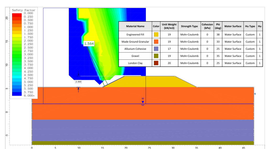
Using techniques such as the Limit Equilibrium Method (LEM) and Finite Element Method (FEM) to calculate the Factor of Safety (FoS), which indicates how close a slope is to failure.
• Key Influencing Factors :
Slope behavior is influenced by cohesion, friction angle, pore water pressure, external loading, and rainfall patterns. Groundwater conditions are especially critical, as rising pore pressures can reduce shear strength and trigger slope movement.
• Failure Modes :
Assessments consider potential mechanisms such as shallow slips, deep-seated rotational failures, rockfalls, and debris flows. Each failure mode requires a different mitigation strategy.
• Mitigation Planning :
May include drainage improvements, slope regrading, retaining structures, or reinforcement systems such as soil nails and anchors.
Slope stability is not static—it evolves with weather conditions, construction activity, and groundwater changes. Ongoing monitoring and reassessment are often essential for long-term site management.
If you are working on a site with steep terrain, sensitive infrastructure, or a history of instability, a slope stability assessment is essential for safe design and effective risk mitigation. Let me know if you would like to explore methods tailored to British Columbia’s conditions or specific project types.